Drones, satellites, AI, and cloud computing
By Esther Shein
Originally published on Jan. 13, 2021, on Hewlett Packard Enterprise’s Enterprise.nxt, publishing insights about the future of technology.
Firefighters are using satellites, AI, drones, and cloud computing to fight wildfires more intelligently.
You might not think a leaf contains valuable data, but how wet or dry a leaf is can help predict the spread of a wildfire.
“Dry plants catch fire; wet don’t,” says Krishna Rao, a PhD student in earth system science at Stanford University. While that might seem obvious, just how dry is dangerous and how wet isn’t dangerous is less clear cut. That is why Rao developed a deep learning algorithm that estimates fuel moisture.
“What makes fires dangerous is fuel,” he says. “Where there’s fuel, there’s fire.”
Increasingly, AI is helping predict how big fires might get and where they might spread, all in an effort to aid in the fight against wildfires.
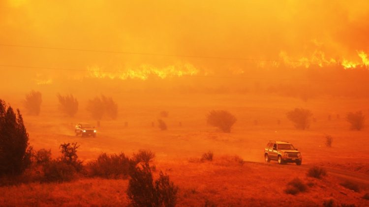
The fight is getting harder: Wildfires around the western half of the country are starting earlier and ending later each year, according to the California Department of Forestry and Fire Protection. This past wildfire season may end up as one of the worst on record: As of Dec. 4, 52,834 wildfires burned 9,539,554 acres. That’s approximately 2.2 million more acres burned than the 10-year average and almost twice the acreage burned to this point in the 2019 season.
When Rao started researching wildfires, he realized they are affected by tree heat factors and meteorological drivers such as winds and precipitation. Humans, of course, are another factor, but so is fuel moisture. Rao found available research in predicting lightning and fire ignition but not in predicting fuel levels.
“If I can tell how dry a forest is, I can predict how much fuel is available,” he says.
That’s where leaves come in. There are a number of factors in a branch and leaf that help determine whether they will ignite. Rao and fellow researchers combined about 20 data points — including the leaf’s color, the amount of microwaves transmitted from a satellite through that leaf, tree height, and the type of plant species — to determine a percentage of how wet the leaf or tree part is.
A satellite radar bursts microwaves at an area of forest, Rao explains. “If the trees are dry, nothing happens; the microwaves just pass through. If the trees are wet, they reflect the microwaves back to the satellite.” That means there’s a low risk of fire.
The model has been tested in the western part of the country in about 12 states prone to wildfires on more than 100 species of trees. “It’s not 100 percent, but right now, it’s the best benchmark for predicting forest dryness in the U.S.,” Rao says.
He and his colleagues used data collected by the U.S. Forest Service — about a quarter of a million samples over three decades — to validate the algorithm. Right now, the model is about 70 percent accurate across states, time, and species. The next step is to use the forest dryness measurements and quantify the value of the forest maps to forecast the risk of wildfires. “Until now, we did not have any forest dryness maps,” Rao says.
The most valuable use of AI in fighting wildfires is using data to predict how things burn and fuel model conditions.
SIMON WEIBEL DRONE AMPLIFIED
AI-powered drones are also helping. A system called IGNIS from Drone Amplified, for example, carries a payload of chemical spheres the size of ping pong balls that are injected with glycol, which explode when they hit the ground and start a small fire. This robs an approaching fire of the fuel it needs to spread.
The idea is that starting fires helps put others out, says Simon Weibel, a former firefighter who works in sales and operations at Drone Amplified. Dropping water slows a fire down, at best, says Weibel, who served on hotshot crews and with the Oregon Department of Forestry and specialized in burnout operations.
One of the tactics hotshots use is called backburning, which is building a containment line or using preexisting containment lines “and creating a controlled fire that you send back to the main fire,” Weibel says. “The theory is, once fuel burns, it can’t burn again. So, if you have a grass fire moving toward you and you start fire toward it, once they come together, there’s no more fuel to burn and it goes out.”
IGNIS works with different commercial drone platforms and uses an Android app that monitors and controls flights and ignitions. It can do automated missions and mapping, manual ignitions, and scouting, and take visual pictures and recordings.
“We’re not talking about replacing firefighters; we’re talking about … how to stretch those resources,” Weibel says. “The term we use is force multiplier.”
The most valuable use of AI in fighting wildfires is using data to predict how things will burn and what fuel model conditions are, Weibel says. “When we have a fire start and we put in the terrain, fuel types, weather, area, all the variables … [AI models] will tell you what that fire is going to be doing.”
Then there is the reconnaissance aspect. “When I was with hotshots, we couldn’t see over the hills, so we did a lot of guessing. Now, you can put a drone up and see over a hill and see what your fire is doing, and that’s the first step in making better judgments on the fire line,” he says. That way, Weibel adds, you can use tactics that maximize the efficiency of ground forces.
IGNIS made its debut during the Pine Gulch fire in Colorado in July 2020, which became the largest wildfire in Colorado history. It was then used in several of the California wildfires and in the Lionshead fire in Oregon in August.
Weibel says there were no issues with the system. If a firefighting team wants to drop balls 10 feet apart, that gets plugged into the app, “and no matter how you move, the system will drop a ball every 10 feet or whatever it’s set at. That’s the brain,” he says. “It’s built around elevation data so you’re able to fly in mountains” and IGNIS provides feedback.
This will be the future of fighting wildfires, Weibel predicts. “I think AI will take that [prediction] capability and push it to the farthest extreme. You’ll be able to look into the future of what the fire is going to do.”