
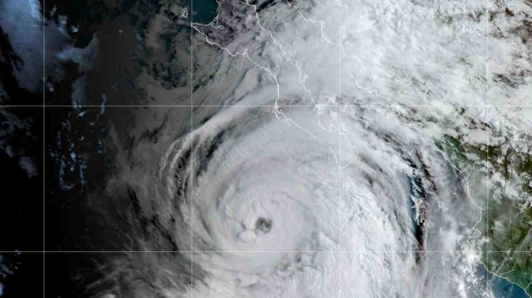
The heat wave finally breaking in San Diego may be partially responsible for the rough tropical weather expected to hit the region on Friday.
National Weather Service forecasters say San Diego could still get drenched as Hurricane Kay begins to weaken and move west.
“The rain will be widespread Friday and Friday night,” National Weather Service meteorologist Alex Tardy said.
Precipitation amounts are unclear, but, as the storm moves in an opposite pattern, more moisture will fall in the desert region of the county than in the coastal zone.
Flash flooding is a concern because a lot of rain is likely to fall in a short period of time.
Hurricane Kay has already hit the central Baja California coast. Big waves hit coastal communities, and rain drenches the peninsula.
The wind is also blowing the Mexican coast, and forecasts say that it will be windy in San Diego as well.
The tropical storm comes on the heels of one of the region’s longest and most intense heat waves.
“From Salt Lake, Sacramento to San Diego, Los Angeles and most of those areas in between, its top-three warmest for a seven-day stretch,” Tardy said. “In some cases, like Salt Lake and Sacramento, number 1.”
The high pressure area, or heat dome, allowed the warm weather to sit over the West, and also likely pulled the hurricane north toward San Diego.
“This requires this kind of harmony between the atmospheric circulation that provides this northern flow along the western edge and then also a storm that gets caught up in that,” said Dan Cayan, a climate researcher at the Scripps Institution of Oceanography.
Cayan said it is not common for hurricanes to form south of San Diego and then track north along the coast of Mexico. Storms typically move west toward Hawaii.
He tracks surface temperatures in the western Pacific and western Atlantic that are up 4 degrees Fahrenheit compared to the average temperatures of the rest of the oceans. The large pools of warm water can affect things like currents and habitats—and they can also change how weather systems respond to the ocean and atmosphere.
“We haven’t had as many storms in recent months, which allows the heat to accumulate on the surface,” Cayan said. “It doesn’t get excited, and as a result we get sea surface temperature anomalies that are extremely warm.”
Although the ocean is getting warmer in spots—and generally warmer—the Pacific waters near San Diego are still too cold to support a hurricane. If a tropical storm were to move north, it would quickly lose strength as it hits the cooler waters, Cayan said.
The monsoonal weather pattern that brought moisture to San Diego during the heat wave will help bring the storm’s edge to the region.
County officials handed out free sandbags at various locations and allowed residents to fill them.
Robert of Spring Valley picked up a dozen because he’s worried about mud flowing from his sloping yard onto his front porch and into his house.
“We have no moisture in the ground,” he said. “Rain will come, and it will supersaturate, and things will slide. Things will get slippery and nasty.”
The mud will accumulate, he said, and flow into the doorway if there are no sandbags to keep it at bay.
What heat transfer causes hurricanes?
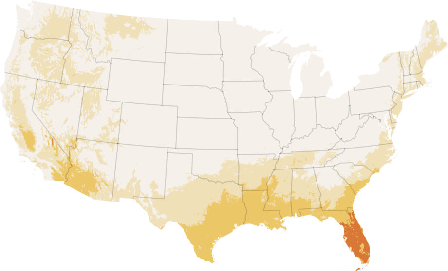
Hurricanes form when rapid heat transfer from the tropical sea surface to the atmosphere combines with the Coriolis force to produce huge whirlwinds with wind speeds over 75 mph. Hurricanes are known as typhoons in the Far East and are called cyclones in India.
How is heat transfer involved in hurricanes? When an air parcel reaches the hurricane’s eyewall, it drifts upward and rises due to a process called convection. The added heat from the ocean causes the air rising in the eyewall to be warmer than the surrounding air, allowing it to continue to rise.
What convection causes hurricanes?
The heat hurricanes generate is from the condensation of water vapor as it rises convectively around the eyewall. The lapse rate must be constant around the eyewall to ensure that the rising air gap continues to rise and water vapor condenses.
What weather is caused by convection?
If conditions allow, this air can continue to rise, cool as it does, and form cumulus clouds. Stronger convection can cause much larger clouds to develop as the air rises higher before cooling, sometimes cumulonimbus clouds and even thunderstorms.
What does convection mean in hurricanes?
Convection is the transfer of heat through movement of a fluid such as air. Convection occurs in the atmosphere when the air near the Earth’s surface is heated. This heating causes the air to expand, become less dense than the surrounding air, and rise. The heated air is buoyant and transports heat energy upwards.
How does latent heat fuel a hurricane?
Their energy source is water vapor that evaporates from the ocean surface. Water vapor is the “fuel” for hurricanes because it releases the “latent heat of condensation” when it condenses to form clouds and rain, warming the surrounding air.
How does the latent heat of water fuel the formation of storms?
When the surface water is warm, the storm absorbs heat energy from the water, just as a straw absorbs a liquid. This creates moisture in the air. When the wind conditions are right, the storm becomes a hurricane. This heat energy is the fuel for the storm.
How does latent heat impact the formation of hurricanes?
Hurricanes are fueled by the latent heat energy released from condensation. To form and develop, they must be provided with a constant supply of warm moist air for this process. Surface air with enough energy to generate a hurricane exists only over oceans with a temperature greater than 26.5°C.
Why hurricanes tend to move west across the Atlantic then turn northeast up the US east coast?
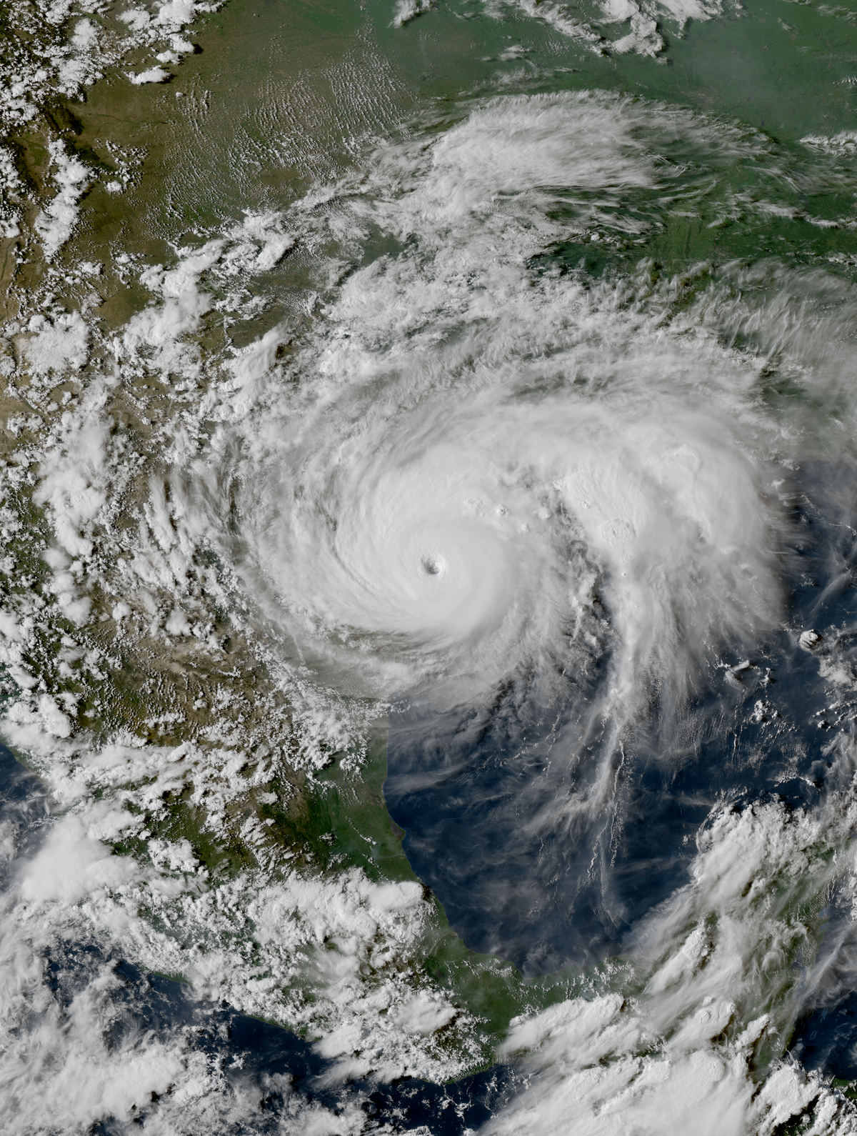
“Hurricanes almost always form over ocean water warmer than about 80 degrees F. in a belt of generally east-to-west flow called the trade wind. They move west with the trade wind and also turn slowly poleward.
Why do hurricanes in the North Atlantic go from east to west and then turn north? Hurricanes in the North Atlantic Ocean initially move from east to west due to the prevailing winds, the trade winds. Then why do they turn north? The Coriolis effect deflects their motion northward.
Why do hurricanes hit the East Coast and not the West Coast?
First, hurricanes in the northern hemisphere move east to west, which means storms that form in the Atlantic head directly for the American mainland, while in the Pacific typically away from the land and from the sea. Second, hurricanes need warm water to form.
Why does the East Coast have more hurricanes?
Hurricanes affect the East Coast of the United States because they tend to “move in a west-northwest direction after forming in the tropical and subtropical latitudes” (Landsea). The fuel that drives these cyclones is warm air and water, and the Gulf Stream along the east coast provides this source of warm water and air.
Why do hurricanes hit the Gulf and Atlantic coast but not the Pacific coast?
Warm water acts as jet fuel for hurricanes and warmer water exists in the Atlantic, especially near the equator and in the Gulf of Mexico. Sea water in these areas can top 80 degrees. But the ocean temperature in the Pacific is usually below 75 degrees, even around 60 degrees in the upper northwest.
Why do most storms move from the west coast of America to the East Coast group of answer choices?
The reason they mostly move from west to east is because of the jet stream. The jet stream is a narrow band of fast, flowing air currents near the height of the tropopause that flow from west to east. The jet stream flows around the entire earth. They usually have a meandering, snake-like shape.
Why does wind travel from west to east?
In general, the prevailing wind blows east-west rather than north-south. This happens because the Earth’s rotation generates what is known as the Coriolis effect. The Coriolis effect makes the wind systems counterclockwise in the northern hemisphere and clockwise in the southern hemisphere.
Why do hurricanes that affect the US travel in an east to west direction?
Hurricanes move from east to west because they are caught in the trade winds that blow from east to west near the equator. Once a hurricane moves north of about 30 degrees latitude, it often gets, and often moves from west to east, like most of our other weather.
Why is latent heat called so?
It is derived from the Latin latere (to lie hidden). Black used the term in the context of calorimetry where a heat transfer caused a volume change in a body while its temperature was constant. Unlike latent heat, sensible heat is energy transferred as heat, with a resulting temperature change in a body.
What is latent heat class 11? Latent heat is defined as the heat or energy that is absorbed or released during a phase change of a substance. It could be either from a gas to a liquid or liquid to solid and vice versa. Latent heat is related to a property of heat called enthalpy.
What is latent heat with example?
Examples of Latent and Sensible Heat An enormous amount of energy is released when water boils. Because water has such a high heat of vaporization, it is easy to get burned by steam. Similarly, considerable energy must be absorbed to turn liquid water into ice in a refrigerator.
What are the two examples of latent heat?
| Material | melting point (°C) | SLH of fusion kJ/kg |
|---|---|---|
| carbon dioxide | â78 | 184 |
| ethyl alcohol | 114 | 108 |
| hydrogen | â259 | 58 |
| leading | 327.5 | 23.0 |
What is an example of latent heat transfer?
Energy is not lost during latent heat transfer. For example, melting ice causes latent heat to be absorbed. When water freezes, the latent heat is released. Similarly, when water evaporates, it absorbs energy, but when water condenses, energy is released.
What is latent heat SI unit?
The specific latent heat of a substance is the amount of heat energy required to change the state of a unit mass of a substance. EL = ml where EL is the heat transferred, in joules, m is the mass, in kilograms, and l is the latent heat in joules per kilogram. The SI unit for specific latent heat is Jkgâ1.
What is the SI and CGS unit of latent heat?
The SI unit of latent heat is J/Kg and the CGS unit is Cal/g respectively.
What is the SI unit of latent heat of fusion class 9?
Therefore, the correct answer is (C) Jkg.