Towards identifying and quantifying the impacts of illegal dumpsites in developing countries
The machine learning classifier can inform on the location and extent of informal waste sites by solely using freely available data sources. To gain additional insights on the impacts of the identified dumpsites on communities and the environment we used another open source dataset, Open Street Map, which provides geospatial information on features such as buildings, river networks and shorelines. In combining all these data sources and derived insights we can address the following questions:
- How many dwellings (community homes, schools, hospitals) and people are in direct vicinity of dumpsites?
- How close are the landfills to the beaches, coast and ocean?
- How close are landfills to rivers?
We analysed three main informal dumpsites in Freetown: Kingtom, Granville Brook and Waterloo.
Making the case for prioritising dumpsite remediation and effective waste management
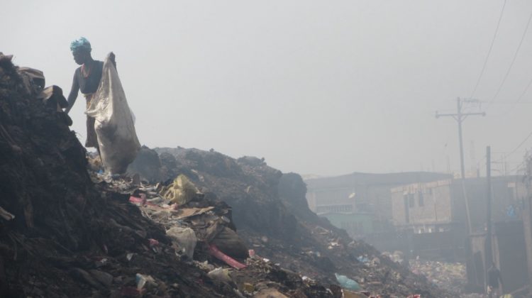
Our analysis demonstrates that each of the three dumpsites in Freetown directly affects over 5,000 dwellings. The communities in these areas suffer from diseases such as cholera, related to polluted waters. All three landfills are also located directly next to or within river channels and are within only a few hundred meters to the ocean. Their existence results in toxic contamination of this natural environment.
Imagine the uncontrolled, constant waste accumulation of a population of over one million people — this is the case of Freetown. Illegal dumping at scale in the developing country context is a causative factor of many major challenges in disease control, air quality, biodiversity loss and environmental degradation. Put another way, many of these challenges in this context can be attributed as symptoms of lacking waste management and massive scale uncontrolled waste accumulation. It is important to treat these symptoms, but it is also arguably more important to treat their underlying cause.
What is next?
There are many more questions we will need to answer to fully understand the impact of landfills on human lives and the environment. A consistent, data-driven, evidence-based framework could provide information on the interconnected waste issues such as diseases, air pollution, environmental pollution, decrease in biodiversity, water pollution and soil contamination. This would inform stakeholders which areas have the highest impact and associated risk to allow optioneering of remediation solutions and efficient allocation of funds. The growing archive of Earth Observation data presents strong opportunities to fill many of the data gaps and monitor our achievements towards the sustainable development goals in a consistent framework.
For more information
Please contact Mandy.Maas@arup.com, Grace.Campbell@arup.com
Find out more
If you would like to learn about Digital at Arup read more about our work here.
